Texas Weather Today: A Close Eye on Far West Texas as the Week Unfolds
TEXAS — Here's the big weather story today: Texas is a huge state, and the forecast isn't the same from El Paso to Houston. A localized severe-thunderstorm concern in Far West Texas deserves attention, while much of the rest of the state has a different set of day-to-day weather questions. The key is knowing which forecast applies to your community—not assuming a colorful statewide map means everyone faces the same threat.
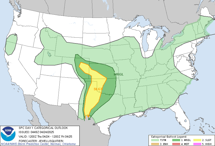
Let's start in Far West Texas. The Storm Prediction Center's October 27 outlook identified a Marginal Risk for a small portion of the region. That's the lowest of the SPC's five severe-thunderstorm risk categories. It signals a limited, localized possibility of severe weather—not a prediction that widespread damaging storms will occur. For the exact area and timing, check the dated SPC outlook and local National Weather Service forecast.
What we're watching on radar
Take a look at the large map above. That display is observed live radar, which helps show precipitation being detected now. It is not a future forecast and it is not the HRRR model. When storms are moving, radar can help viewers follow the latest picture—but a warning from the National Weather Service always takes priority over a general radar display.
The 6 PM HRRR forecast: why the clock matters
Here's where weather models become useful. The High-Resolution Rapid Refresh, known as the HRRR, produces frequently updated short-range forecasts. Its simulated-reflectivity product can suggest where rain or thunderstorms might appear at 6 PM. For today, that's 6 PM CDT / 23:00 UTC. But the model run time and forecast hour must be verified together. We have not verified that specific frame, so this preview does not pretend the live radar is a 6 PM HRRR forecast.
Central Texas: a more comfortable afternoon
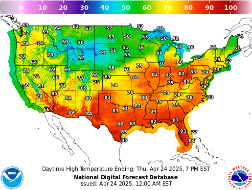
In a broad Texas forecast snapshot available for this afternoon, temperatures were around the upper 70s, with clouds mixing with some sunshine and a daytime high near 80 degrees. That's a useful general picture, but it is not a city-by-city observation. If you're in Austin, Marble Falls, San Antonio or the Hill Country, check the latest local NWS forecast before making outdoor plans.
Rainfall, temperatures and drought: four maps, four different stories
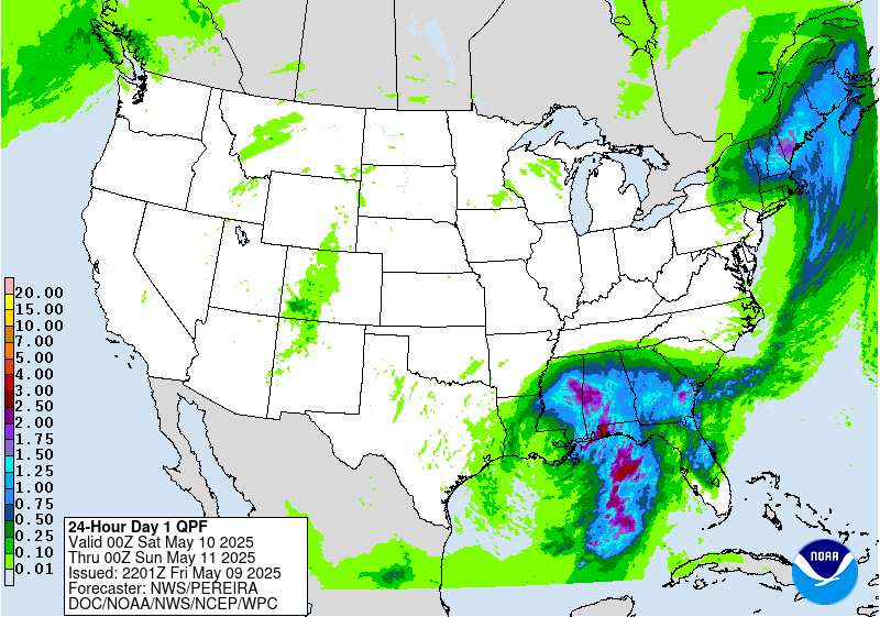
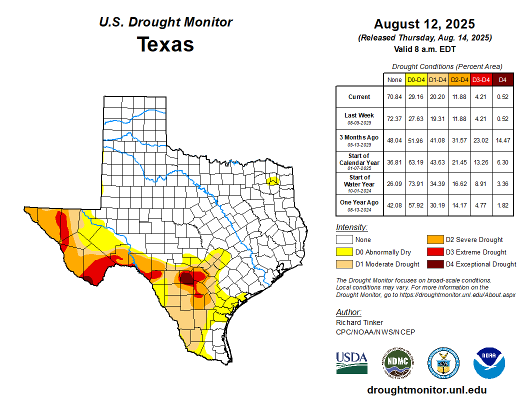
Now look at the panels to the right. The SPC map addresses severe-storm potential. The NWS temperature graphic depicts a forecast period, not necessarily the temperature outside your door right now. The Weather Prediction Center rainfall map shows projected accumulation over its labeled forecast period. And the U.S. Drought Monitor is a weekly assessment—not a live picture of rain falling today. Each panel can update after this article was published, so check the source timestamp.
What happens next?
Our focus through the next 24 to 72 hours is whether localized thunderstorm chances change, where the most meaningful rain opportunities develop, and whether any official watches or warnings are issued. We'll distinguish between what a model suggests and what forecasters have confirmed. That's the difference between a dramatic-looking weather graphic and information you can actually use.
Bottom line: Keep an eye on Far West Texas for the localized severe-weather concern, use the current radar for what's happening now, and rely on dated NWS and NOAA forecasts for what comes next. Texas News Studio will continue following the developing weather picture.
Editor's note: This is a dated editorial sample. The embedded weather maps are live or regularly refreshed external products and may no longer represent October 27. No unverified HRRR simulation or invented storm track is displayed.