Ancient Babylonian World Map: What Lies at the Edge?
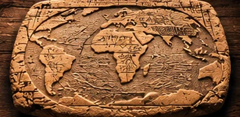
Thousands of years before satellites and digital maps, ancient people were already trying to picture the world around them. A Sumerian-era map offers a remarkable window into that imagination.
Here is the situation
The Babylonian Map of the World, often called the Imago Mundi, depicts a stylized world centered on Babylon and surrounded by water, with regions beyond. It is a remarkable record of ancient geography and cosmology, not a modern survey of the entire planet. The tablet is Babylonian rather than proof that the Sumerians mapped every continent.
The bigger picture
TNS explores what the artifact tells us about ancient ideas and where modern video interpretations stretch beyond the evidence.
What happens next
What ancient mapmakers believed lay beyond the familiar world is fascinating history—not a modern discovery of a literal edge of Earth. Tex will keep you updated on this story right here at Texas News Studio.
Primary reference: https://www.britishmuseum.org/collection/object/W_1882-0714-509